Image by the Met Office
Last Updated: 21 January 2025
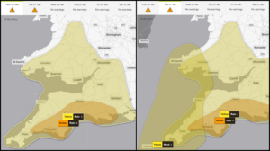
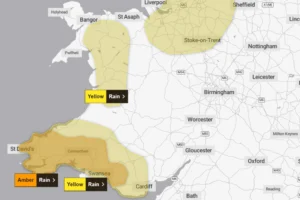
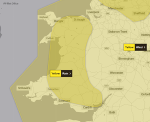
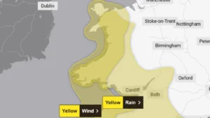
Two yellow weather warnings have been issued for Wales as Storm Éowyn prepares to unleash powerful winds across the region. The Met Office has forecast coastal gusts reaching 80mph, with inland areas expecting winds up to 60mph. ⚠️
“Storm Éowyn is expected to pass close to or across the northwest of the UK on Friday before clearing to the northeast on Saturday,” states the Met Office warning, highlighting a period of “very strong winds” initially coming from the southeast before shifting westerly.
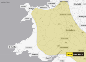
The first warning begins at 00:00 Friday, January 24, covering north and west coastal areas. A second warning encompasses the rest of Wales, including major areas such as Cardiff, Swansea, and Wrexham.
The Met Office’s Wales forecast predicts: “Turning wet and increasingly windy. Persistent rain, heavy at times spreads eastwards through Thursday and Friday. Frequent, blustery showers to follow on Saturday, though some brighter breaks too.”
Meteorologists have identified potential “explosive cyclogenesis” – commonly known as a “weather bomb” – which could bring the “strongest winds of the year”. The jet stream’s core winds are expected to exceed 260mph (418km/h) above the Atlantic.
Storm Éowyn marks the fifth named storm of the 2024/25 season, following Darragh, Conall, Bert, and Ashley.