(Image: Met Office)
Last Updated: 26 January 2026
Wales is preparing for another battering as Storm Chandra becomes the third major weather system to strike the UK this month, following the chaos caused by Storms Goretti and Ingrid.
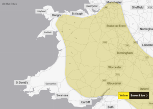
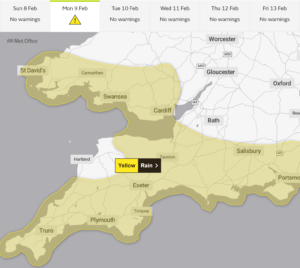
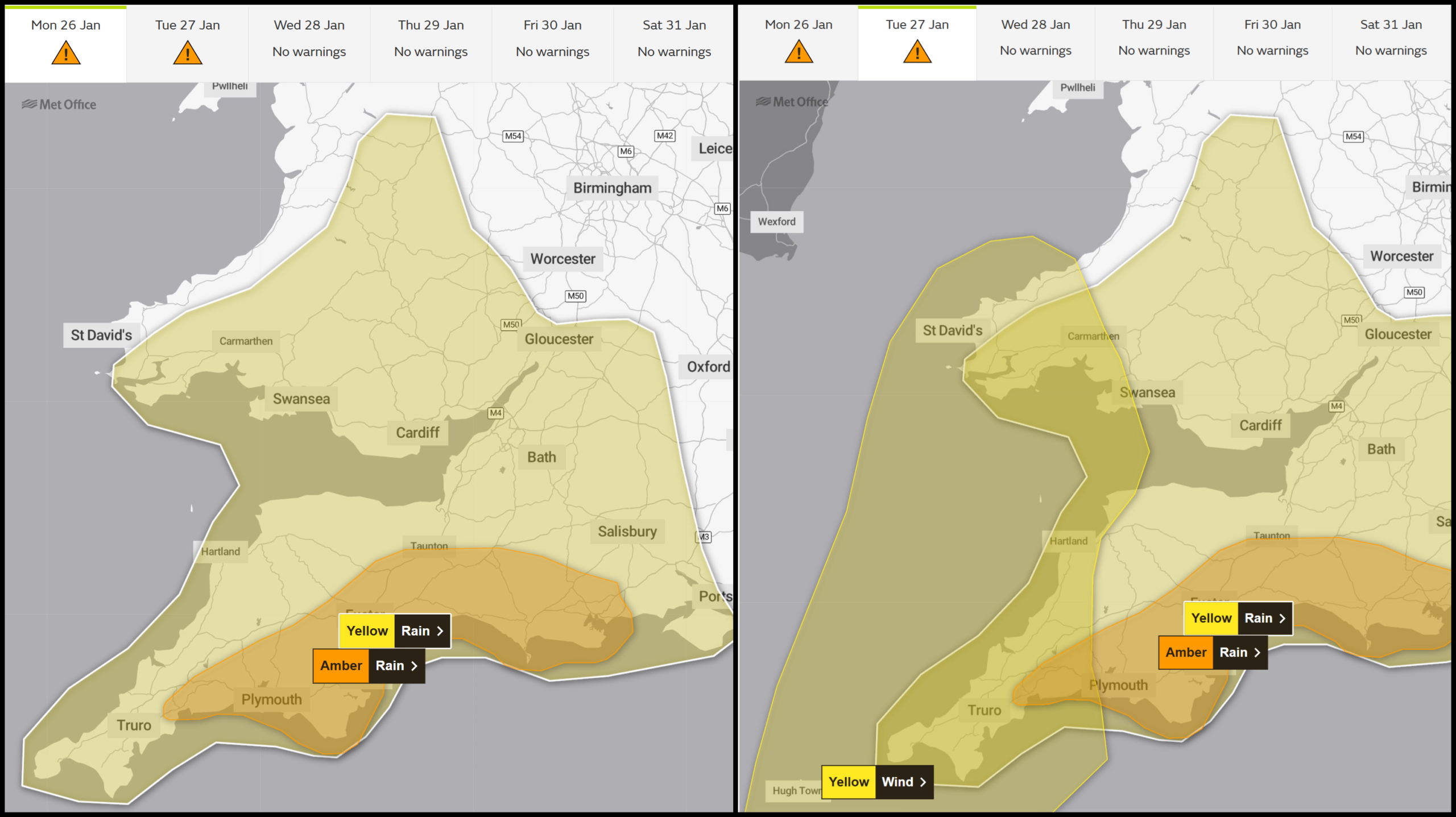
Met Office forecasters have issued yellow warnings for both wind and rain across large parts of the country, with Tuesday expected to bear the brunt of Chandra’s fury.
The storm will unleash relentless downpours and powerful south to south-westerly gales throughout the day. Inland areas could see winds reaching 60mph, whilst coastal communities should brace for gusts up to 70mph.
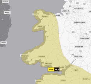
Pembrokeshire and the Isles of Scilly face the most severe conditions, with the Met Office warning: “There is a small chance of gusts up to 80mph for parts of the Isles of Scilly and Pembrokeshire.”
Heavy rainfall will hammer south and mid Wales from 1pm Monday through to 10am Tuesday. Most areas will see between 20mm and 30mm of precipitation, but Bannau Brycheiniog – the Brecon Beacons – could endure a deluge of up to 80mm.
The rain warning affects: Blaenau Gwent, Bridgend, Caerphilly, Cardiff, Carmarthenshire, Ceredigion, Merthyr Tydfil, Monmouthshire, Neath Port Talbot, Newport, Pembrokeshire, Powys, Rhondda Cynon Taf, Swansea, Torfaen, and the Vale of Glamorgan.
Wind warnings from 5am to 4pm Tuesday cover south-west Wales, including Carmarthenshire, Ceredigion, Pembrokeshire, and Swansea.
With ground already waterlogged from previous storms, flooding of homes and businesses poses a significant threat, alongside inevitable travel disruption.
Residents in at-risk areas should prepare flood plans and emergency kits. The Met Office recommends gathering torches, batteries, mobile phone power packs, and other essentials in case of power failures.
Traffic Wales is urging motorists to reduce speeds in heavy rain, maintain safe distances from other vehicles, and avoid driving through floodwater of unknown depth by finding alternative routes.